
Skip to product information

**Please note: Actual layout may vary based on size. If you'd like to see a proof of the layout prior to production, let us know,


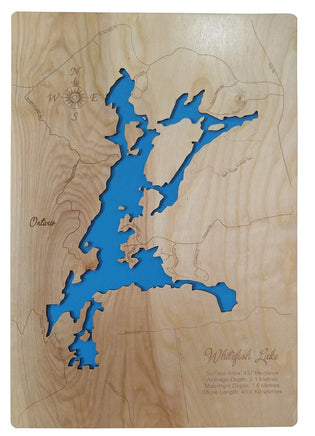
This is a beautiful, detail, laser engraved and precision cut map, including lake information such as surface area, elevation and maximum depth.
Styles
Contemporary
The contemporary map has finished edges with gently rounded corners. It casts a small shadow when mounted on the wall. It is also suitable for display on an easel.
Framed
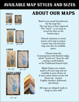
The classic framed style features a handmade frame in your choice of 4 stain colors: ebony, natural, driftwood and, our most popular, English Chestnut.
Included With All Maps:
- Points of interest laser engraved into the map face
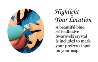
- A blue, self-adhesive Swarovski crystal to mark your preferred location on the map
Our maps are made from beautiful birch plywood. Natural variances in the wood grain ensure a unique work of art. Once the map is cut, it is hand sanded multiple times, mounted on a blue board to highlight the water, and given a clear coat for a lustrous wood shine. Proudly made in the USA by American workers in an American owned business.
**Please note: Actual layout may vary based on size. If you'd like to see a proof of the layout prior to production, let us know,
Custom Engraving Available
Add up to 2 lines of custom engraving at no additional cost!
Standard Engraving:
- Surface Area: 437 Hectares
- Average Depth: 2.1 Metres
- Maximum Depth: 7.6 Metres
- Shore Length: 48.8 Kilometres